A few weeks ago I introduced the first beta of the Kyanite Facebook archive viewer. Today I’m announcing the second beta release complete with a bunch of bug fixes and new features. My favorite new feature is the map view for browsing/filtering posts that have geospatial information. You can get the latest version for download here .
Map View
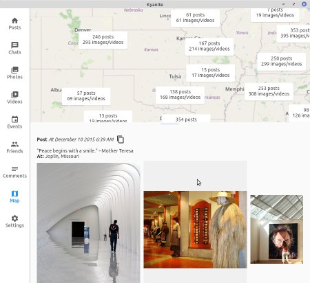
One of the things I often did with Facebook was try to remember a place I visited to eat or visit. For example a friend asked me for a restaurant recommendation in a major city I went to many times. Unfortunately the name of the restaurant was a bit too generic to triangulate it via a regular cold internet search. But I remember that I took a picture at that restaurant and posted it to Facebook…at some point. Facebook search is useless for trying to find it via text search but they do have a feature that let me go to a map and start zooming in and around until the data jumped out at me. While Kyanite has much better text search than Facebook it would still be a very cumbersome process. That’s why I’m so excited for the new Map View tab:
The map view screen is divided into two parts: the map on the top and a list of selected posts on the bottom. There is a slider that that lets the user decide how much of the view they’d like to make the map use at the expense of the posts timeline. The posts timeline itself is identical to the one found on the main Posts tab except that it is only showing the posts that correspond with the summary billboards on the map. The initial view is zoomed out globally but centered on about the average mid point of all your geographic data. For world travelers this will be less interesting but for those that are mostly in one area, like in this example dataset where the posts are all in the United States, it will center the map approximately where you are, as shown below:
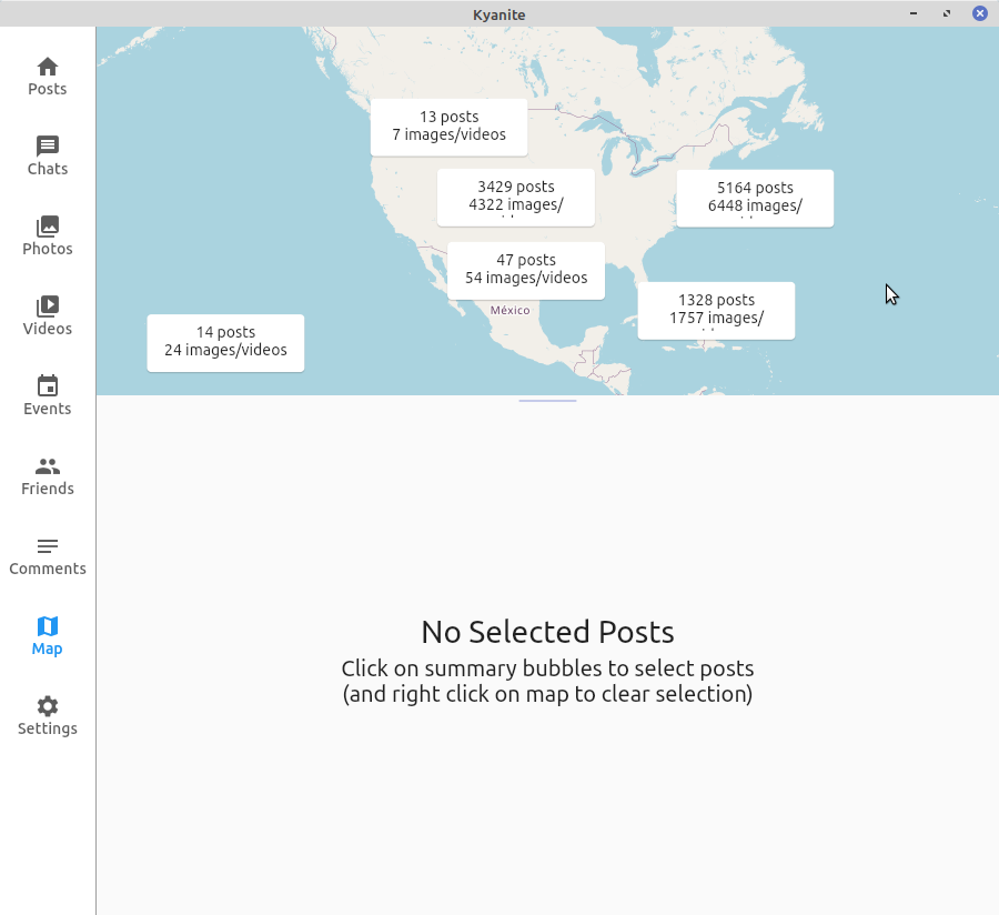
Billboards are put on the map geographically located and with all of the posts which are covered by it. As you pan and zoom the map it is being continually re-evaluated. If at any point you want to see the actual posts that are in a billboard you simply left-click on it. Right clicking anywhere else on the map clears that selection. Back to my example above, I can start zooming into the are and slowly see how the posts evolved. Because this is backed by standard map systems the map will zoom down with details all the way down to street view.
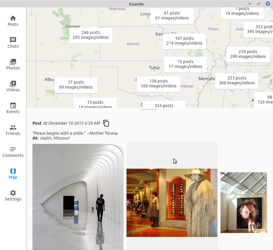
Image Carousel
A common use case is that you open a post that has multiple images, or you are in a photo album, and you want to see the full sized image. What happens when you want to see the previous or the next image? In Beta 1 the user would have to go back a screen and click on the next image. In Beta 2 we now have forward/backward arrows that can be used for cycling through the images in the post/album:
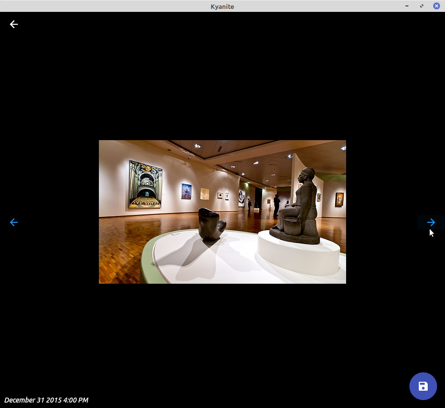
The user therefore can cycle through the images seamlessly and like before if they find one they like they can export it with the save button. Along with the on-screen buttons the carousel is also usable with the forward/backward arrow keys. Likewise hitting the Escape key will dismiss the window like the go-back arrow on the header bar.
Post/Comments/Conversations Copy to Clipboard
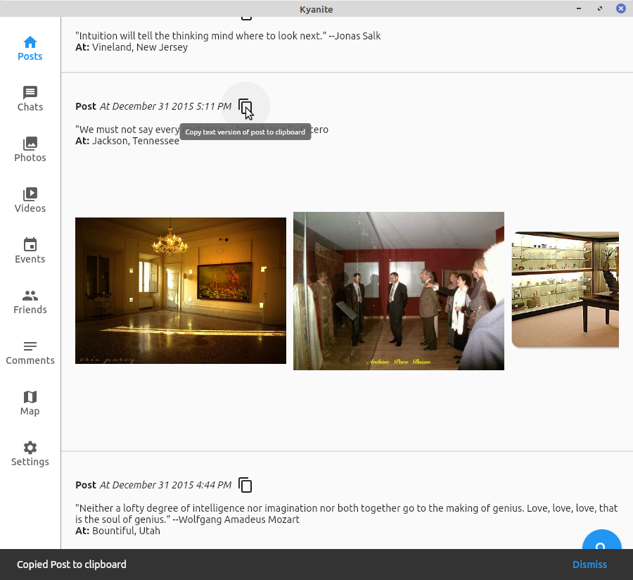
In Beta 1 users could select text to copy/paste it to the clipboard. However that would be cumbersome to get all of the post details. In Beta 2 we added a “Copy” button to each post/comment/conversation line. This button generates a human readable text only version of the post that is added to the system’s clipboard. In there will be things like the title, the post/comment/conversation text, the local path to the image files, the hyperlinks, etc. When the text is finished being copied to the clipboard Kyanite puts up a snackbar status to let you know it is completed, which will be nearly instantaneous. Below is an example of the plain text that is copied to the clipboard from a post:
Title:
Creation At: December 31 2015 5:11 PM
Text:
"We must not say every mistake is a foolish one." --Cicero


Photos and Videos:
/home/hankg/tmp/test_archive/posts/media/TimelinePhotos_aoeu/69f5010332334ba6a5773e0ced547a1b.jpg
/home/hankg/tmp/test_archive/posts/media/TimelinePhotos_aoeu/423fb91b4e664192b179a0163aa85c92.jpg
/home/hankg/tmp/test_archive/posts/media/TimelinePhotos_aoeu/ed2cfdc34cfd425e9b5ce7d94a0da38c.jpg
Name: Jackson, Tennessee
Latitude: 35.6145169
Longitude: -88.81394689999999
Bug Fixes
During early testing of Beta 1 some bugs were found that have been squashed. There was a pretty serious memory leak that has been resolved. There was also a major bug where on certain platforms the default video player was being set to nothing thus causing an exception that would crash the app. The setting it to the wrong setting is fixed and the error handling is more pervasive to prevent it from crashing and to report it to a log. Lastly there were some capitalization inconsistencies in the user interface which have been standardized. As always if you have bugs or feedback you’d like to make on the project, feel free to use the Issue Tracker or send an email to this email address .
Notes
The datasets used for the screenshots are created by a random generation program with three sources of data. Cities data is from this GitHub Gist . The quotes which are used for text body are from this Database Quotes JSON Project . Image data is from the Indoor Scene Recognition ML training dataset by MIT .


 2021-12-07
in

 5 min read